Aerial map
Oat St. Health
Birmingham, AL · Medical retail corridor
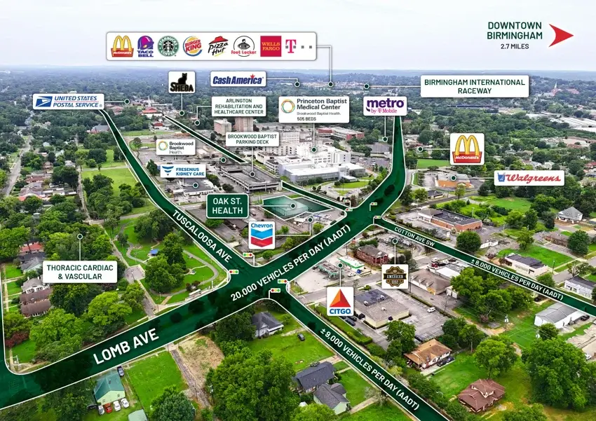
A medical property is understood through more than its street address. Its surrounding healthcare network, access, and neighborhood activity help explain its position.
For this Birmingham location, I created two aerial exhibits connecting the immediate streetscape with the wider market. Traffic annotations, nearby destinations, and regional connections give prospective buyers a clear view of where the property sits and how people reach it.